
The website Greek Reporter is a useful resource for stories about Classical Greece and the Hellenistic world. A recent report outlined the latest theory to emerge to try to identify Thule, or Ultima Thule, as described by Pytheas of Massalia ( Marseilles ) and which survives only in quotations and citations by later Greek authors.
In the years leading up to 300BC Pytheas sailed from his home city, or possibly from the mouth of the Loire, around the islands to the north for which he gives the first record of their name - Britain. He then sailed a further six days northwards to a wintry world of ice and snow, the very limit of humanity. This he named Thule, or Ultima Thule. Where exactly he was has been a source of much speculation. However the latest theory, which looks on the surface reasonable, given our fragmentary knowledge of Pytheas’ work, identifies it as most probably being Iceland. The article making the case can be read at Greek Discovery of Iceland Supported by Linguistic Evidence
It contains a link to an earlier article on the same website about Pytheas’ exploration of the north-east Atlantic, and his recording of Britain, which can be seen at The First Ancient Greek to Reach Britain and the Arctic
To know more about Pytheas, or at least about the theories about him, Wikipedia has a quite detailed account at Pytheas
Both articles reproduce an Italian map made in 1490 that sought to reconstruct Ptolomey’s second century AD map of the British Isles which was based partly on evidence accumulated during the Roman conquest in the previous century and partly based on Pytheas’ measurements.
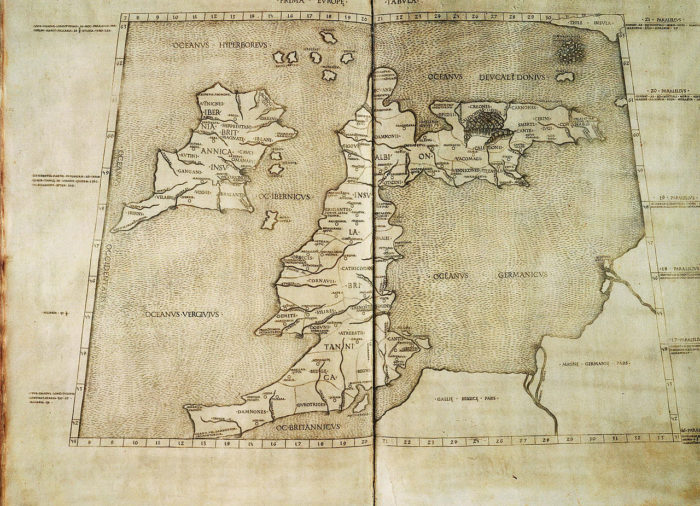
The reconstructed Ptolemaic map
Image: Wikipedia
It may not be the Ordnance Survey, but, all things considered, it is no mean achievement as one looks back across the space of two millennia.
No comments:
Post a Comment